
Taunton Previous Residents by Era
A backward address search depends on the year in question. The land index is the durable route for recorded ownership and instruments. Directories, street assessor lists, census schedules, maps, and the local newspaper add dated household or building context. None of them alone supplies a complete list of previous residents. Begin with the source closest to the date, then check one independent source before treating a name as part of the address history.
| Source | Years It Covers | Where Held | What It Shows |
|---|---|---|---|
| Recorded Land Inquiry | April 4, 1735 to current | Northern Bristol County Registry of Deeds / Bristol North District | Recorded parties, deeds, mortgages, liens, plans, and legal descriptions |
| Land Court Inquiry | August 5, 1903 to current | Northern Bristol County Registry of Deeds / Bristol North District | Land Court instruments and certificate paths |
| Taunton city directories | Selected 1855 to 1980 | Massachusetts State Library holdings and local research channels | Dated address, household, business, and notation clues |
| OCHM Street Assessors Lists | Selected 1902 to 1963 | Old Colony History Museum | Ward, address, occupation, and registered-voter context |
| Federal census schedules | 1790 to 1950 released schedules | Federal census research channels | Household and enumeration-district context |
| Taunton Daily Gazette microfilm | 1850 to present | Taunton Public Library | Obituaries, notices, events, and address-related leads |
Use the registry for recorded title first when the question concerns ownership. For a person listed at the location, choose the nearest directory, street assessor list, or census year. The Massachusetts State Library holdings list, the Old Colony History Museum research resources, and the Taunton Public Library online resources identify those historical routes. The 1898 Sanborn set and a permit record can then test what stood at the site, not who necessarily occupied it.
Taunton Previous Residents Deed Trail
Start a title path with the modern parcel, not a bare street label. The Taunton Assessor / Vision Government Solutions database and MapGeo can supply a current situs form, property ID, and map or lot lead. Use those identifiers to keep a renumbered street or a parcel with more than one address from drifting into the wrong history. The assessor’s owner of record is an ownership clue only. Verify it against the recorded instrument before using it as the next link.
The Northern Bristol Registry of Deeds is the authoritative destination for the recorded land trail and its public-records request route.
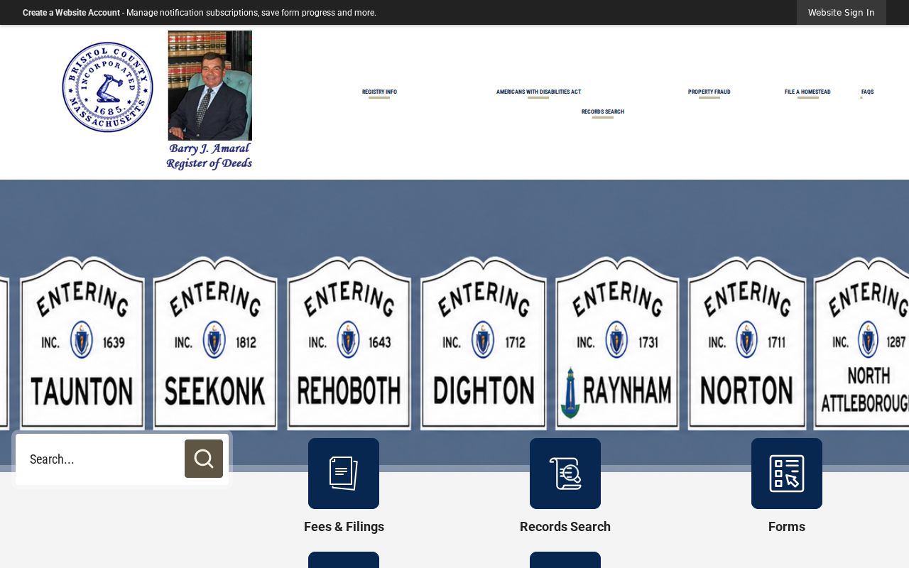
The Registry separates recorded-land, Land Court, plan, street, and image paths. That separation is useful when one address produces an incomplete street result or when an older reference needs an image search.
From the parcel, run the Recorded Land Street Inquiry using the exact and plausible historical forms of the number and street. Then run the current owner and each earlier seller through the Recorded Land Inquiry. The name search requires start and end dates, document type, last name, and town, with a party-direction choice for grantors, grantees, or both. It is the necessary second search because the Registry’s Street Inquiry warns that not all instruments have street fields.
- Record the MapGeo or assessor situs address, property ID, map or lot, and any legal-description clue.
- Search the Recorded Land Street Inquiry by the current and any historic street form, then note document numbers or book and page references.
- Open the current purchase deed or its index entry and identify the seller, recording date, and legal description.
- Search that seller as a grantee to locate the prior acquisition, then repeat through the desired period.
- Reconcile each link against the parcel, plan references, and a second source before adding it to the title chain.
Three registry terms make the backward search easier to document. Copy their wording from the instrument rather than simplifying a name or legal description in research notes.
- Grantor / grantee
- The grantor transfers an interest in the recorded instrument. The grantee receives that interest. A person can appear in both roles at different points in the same chain.
- Chain of title
- The sequence of recorded transfers and related instruments used to trace a parcel backward from a current reference.
- Legal description
- The recorded land description, plan reference, or boundary language that helps distinguish the same parcel from a changed or duplicated street address.
Taunton Registry Index Paths
Recorded Land Inquiry reaches from April 4, 1735, Book 24, through the current date. The separate pre-1885 grantor-grantee image page groups historical index material into 1686-1795, 1795-1840, 1840-1866, and 1881-1910 ranges. Those groups are an index layer, not the underlying deed. Transcribe the party name, book, page, date, and any reference that points to the instrument. Then inspect or request the document before treating an index entry as a complete description of a property transfer.
Northern Bristol pre-1885 grantor-grantee index images provide the earlier-name path for a Taunton address history.
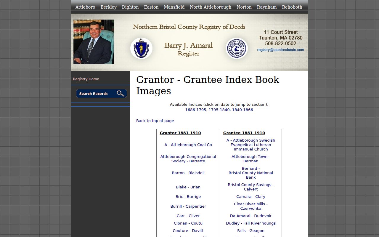
Follow the index reference rather than relying on a surname alone. A property may appear under an estate, trust, corporate, or abbreviated party name, and the legal description is the better test that the instrument belongs to the same place.
Note: A blank street result does not mean the address has no history, because the Registry specifically warns that some documents omit street number and street name fields.
Taunton Previous Residents Land Court
Land Court records are a separate branch of the Registry’s search system. The Land Court Inquiry states coverage from August 5, 1903 through the current date. Use it when an earlier recorded reference, certificate number, plan, or property record points toward Land Court material. Do not assume every Taunton parcel will appear there, and do not substitute a Land Court result for the Recorded Land chain when that is the relevant route.
Northern Bristol Land Court Inquiry is the separate indexed path shown for this address-history research.
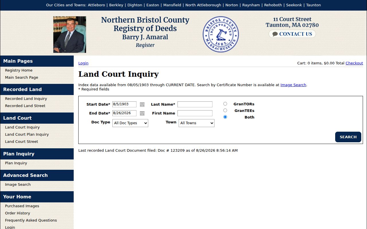
When a result supplies a book, page, certificate, plan, or document number, preserve it exactly. The Registry’s Image Search then offers paths for Recorded Land book and page, date range with town and document type, plan book and page, Land Court document number, and certificate number.
Taunton Addresses That Changed
Taunton City Council minutes from October 8, 2024 record a Woodlawn Street number-change issue involving Registry notice and city engineer and GIS coordination. It is a small but important local lesson: a present-day number does not automatically identify the number used in an old directory or deed index. The minutes do not offer a complete conversion table, so an address match should remain provisional until the City, assessor, GIS record, Registry plan, or postal record supports it.
Test old and new number forms before deciding that two results describe different places. Search the street without a number in the Registry, compare map or lot and plan references, then use directory cross-references, City street-index maps, and ward or precinct maps from the right vintage. Preserve the historic form even after USPS normalization gives a present delivery form. This Taunton quirk prevents a false break in a chain of previous residents.
Pairing Taunton Directories and Census
Once the deed trail identifies a period, move from owners to the people listed at the address. The Massachusetts State Library identifies selected Taunton city-directory holdings from 1855 through 1980, not an uninterrupted annual run. The Old Colony History Museum’s selected street assessor lists cover 1902-05, 1912, 1928, 1930, 1934, 1939, 1950, and 1963. These are dated snapshots. A list can show an address, occupation, and registered-voter context, but it is not a full household census.
Use the catalog and reading details in the Taunton city directory collections when choosing a volume or decoding its printed form. The backward-address task is different: compare the location across nearby years, then test the result against a released census schedule or another independent record.
- Write down the directory year, page, exact address, and every printed notation such as house, boards, business, widow, or removed.
- Check the nearest earlier and later directory issue for a move, spelling variant, or address-number change.
- Use the nearest released federal census year to test household composition and enumeration-district context.
- Compare an OCHM street assessor list where its selected year and ward align with the address.
- Mark a person as a listed address, recorded party, business contact, or unresolved result instead of blending the categories.
Federal schedules from 1790 through 1950 are the released public series identified in the research. A census can supply household context, but an address must still be tested because enumeration order and street numbering do not always line up cleanly.
Taunton Previous Residents Context
The 1898 Taunton Sanborn set has 57 sheets and can show a building’s use, materials, adjacent structures, street configuration, and some house numbers. It is a building-context source, not a list of people. Use it after a dated directory or deed has located the parcel. A change from shop to dwelling, or an altered street layout, can explain why an address appears differently across two records without proving that the same person was there.
The Taunton Public Library identifies Taunton Daily Gazette microfilm from 1850 to the present. Search for an address, name, event, notice, or estate reference, then preserve the issue date and page. An obituary may identify relatives or former addresses, while a public notice can place an estate or transaction in time. No full official name-level online search for the complete Gazette run was located, so library microfilm remains an important access route.
This is another useful comparison: a deed shows a recorded transaction, a directory shows a published listing, a census supplies household context, and a Sanborn sheet describes the physical setting. Together they make a stronger Taunton address history than any one result.
Taunton Probate and Estate Leads
Probate can explain a change in a deed chain when an estate, personal representative, or heir appears as a recorded party. Use Massachusetts Trial Court Case Access for a docket lead, then contact the Bristol Probate & Family Court Registry at 40 Broadway for the file route. The Registry has public access computers in Taunton and Fall River, while older files can be off-site. A docket is not the official file, and protected material may be withheld.
Do not turn a deed party into a family conclusion without corroboration. A recorded estate conveyance may identify a fiduciary rather than every heir. Pair the instrument with a probate file, obituary, vital-record route, cemetery source, or published family evidence when the question is relationship rather than title. This keeps the previous-residents trail factual and limited to what the records support.
Taunton Previous Residents Image Search
The Northern Bristol Image Search is useful after another registry result supplies a reference. It supports Recorded Land book and page, plan book and page, Land Court document number, certificate number, date range, town, and document type paths. It is not a replacement for tracing the chain, because the book or document reference has to come from a parcel, party, index, plan, or earlier instrument.
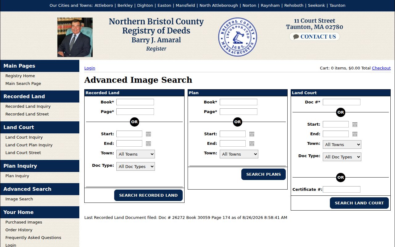
Images and official copies have different roles. The portal describes documents as informational and directs people to the Registry for an official copy. When an online path ends, preserve the date range and reference, then use the Registry counter, mail, or public-records request channel rather than guessing at the missing content.
Limits on Taunton Previous Residents
A house history should state what each record proves. The assessment record can identify a parcel and an ownership lead. A deed identifies recorded parties. A directory or street assessor list places a name at an address in a selected year. A census adds household context. Gaps between those records are normal. The best response to an absent result is to name the custodian, date range, and search path checked, not to fill the gap with an assumption.
Lawful use. Taunton previous-resident research is appropriate for family history, house history, estate questions, and personal curiosity. Do not use a historic address trail to stalk, harass, threaten, or expose a living person, and respect confidential-voter, court, and address-protection rules.